Wednesday, November 30, 2005

Heath Bunting

Heath Bunting

On the 1st Oct 2002 the Tate Modern held a evening seminar where the artist Heath Bunting talked about his project “BordedXing Guide” The archive reads: “Heath Bunting's BorderXing Guide website primarily consists of documentation of walks (he has completed) that traverse national boundaries, without interruption from customs, immigration, or border police. The work comments on the way in which movement between borders is restricted by governments and associated bureaucracies.” Bunting is also concerned with the transformative nature of borders, the way they can turn the skilled worker into “Illegal Aliens”, negating their wealth of skills and life experience. He argues that border guards aren’t checking your identity so much as your “user profile”, your usefulness to the country being entered and he goes on to state that the problem with user profiles is that someone else chooses the criteria. Users of his website need to ask Bunting for permission to enter before they can access the documented unhindered European border crossings that he has successfully undertaken (mostly without the security of a passport), his resource for the wood be “illegal” frontier traveler.
22/11/05 Seminar Information part 3

Willie Doherty

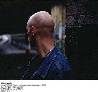
The artist that I find most interesting in relation to my project is Willie Doherty. Doherty was born and still lives close to Londonderry in Northern Ireland and has been making work since 1980. His work comprises both photography and video and is very rooted in his hometown of Derry and of the divide that runs through the city and the province of Northern Ireland. His work often possesses an uneasy tension. Doherty sites his witnessing at the age of 12 of “Bloody Sunday” as being highly influential. This occasion when unarmed Catholic civil rights protesters where killed by British paratroopers was subsequently denied and suppressed through the media and by the British Government (Public enquiry started 2002, report pending). From this early age Doherty was aware of how situations could be twisted by those in power and the media. His work has subsequently played with the notion of dual or multiple readings of events and is almost exclusively made in and around Derry and the adjacent border areas. He is careful not to express partisan opinions in his work, but rather addresses the more universal issues confronting people within similar divided lands.


Thursday, November 17, 2005

22/11/05 Seminar Information part 1


Working Title: Dance!

Perform or participate in a specified dance.
Leap or skip, especially in an emotional manner.
Make somebody dance or lead somebody in a dance.
Talk misleadingly so as to avoid facing an issue squarely.
Get to a particular state by dancing.


Aims

The aim of my project is to create multi media installations exploring the contrast between hard edged political/geographical territory and personal territory with the main emphasis on the human experience within conflict/ex conflict zones.

This work should be:

• Clear and confident in its form

• An engaging self contained environment

• Well marketed

• The start of a growing body of work developed around specific core issues


Rationale

From growing up in Northern Ireland I have always been acutely aware of political and personal landscape and territory, and of the fixed, polarised positions people tend to publicly adopt within areas of conflict. I wish to explore experienced and perceived personal territories within such areas - territories which are not fixed, and which can transcend geographical and/or state borders.

I am interested in how people position themselves and cope, within geographical areas deeply affected by conflict, and within their own emotional landscapes.

I am also looking at the influence technology has on the way we perceive and map the physical and personal landscape that we position ourselves within.

I am interested in the relationship between older forms of media, relatively fixed within their physical structure, and new media, easily transformable into different incarnations due to the fact that it exists within the digital realm. I find the parallels between this idea and the idea of fixed state/national territory and unfixed personal territory interesting.

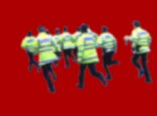
I want to work with footage from news film and video archives, extracting human figures from the footage, and placing and re-animating them within neutral spaces on a screen, mixing figures from different times and spaces. Removing their actions from the context in which they happened, allowing the figures to perform a kind of melancholic dance. The figure will also be thrown out of focus just enough to avoid a more instant catagorisation by the viewer, making each figure relate more to a universal shared experience. Using footage from Northern Ireland news coverage of the troubles, but extracting the specifics of the location, to suggest a more universal experience of people caught up within conflict and changing territories, touching on their dislocation, loss, willpower, strength.
I will also cut these images together with aerial video footage captured from a kite, gathered from state border positions geographically of significance to myself.

This work will be like a kind of dance, with a soundtrack also constructed from archived material, newly recorded material (mainly voice and often abstracted, could include interviews) and computer generated abstract soundscapes. The sound will act as a kind of lens with an ebb and flow of focus, adding focus at points, hinting at possible narratives, then receding back towards a more abstract soundscape, drifting, giving the viewer only brief lucid moments. I see this work conveying a sense of time slowing, an opening up of space, of being meditative, melencolic.


Methodologies

I am researching into the recent history of conflict in Northern Ireland and the effects this has on the population and how they process/avoid processing this experience (self repression?). I have particular interest in how a population copes and continues daily life under these conditions, and the mindset that a conflict can create within the population of that area. I will look more at Blogs created by people within this and similar (ex)conflict zone as a way to her other voices.

For my pgpd essay I researched into the relationship between Nations and States, and of the nature of borders and borderlands. Concentrating mainly with Europe and using a study into the nature of peoples experience within the iIish borderlands.

I have looked briefly at the history of physical mapping up to the present and the forces, both geographical and social, that have driven its development. I will research how people’s idea of personal territory has been affected by technological advancements and economic changes, like live “as it unfolds” 24 hour news, the reduced price of travel, faster affordable portable communication (satellite phones), Global positioning systems (GPS) telling us our location from anywhere on the planet. All these advancements have effectively changed our perception of distance and location, but do they simply give us the illusion of knowing where we are.


Stills from Tryout annimations:


Final show

Current position of project 2/12/05

I am presently still proposing to work with footage from Northern Ireland film and video archives. I will use footage from traumatic events that have become lodged in the memories of its population. I aim to remove their actions from the context in which they happened, extracting human figures from their geographical position within the footage, and placing and re-animating them within more neutral digital spaces, allowing figures from different times and spaces to perform a kind of melancholic dance. The extracted figures will be thrown out of focus just enough to avoid categorization by the viewer, suggesting a more universal experience of people caught up within conflict and changing territories, touching on their dislocation, loss, willpower, strength and similarity of circumstance. I want the figures to have a sense of searching for understanding.

I also think of this blurring as representing a beginning of forgetting, of fading memory. I want to consider this idea of loss of memory as new beginning, specifically relating to the notion put forward by Susan Sontag In her book “Regarding The Pain Of Others”. Sontag wrote, “The belief that remembering is an ethical act is deep in our natures as humans. Heartlessness and amnesia seem to go together. But history gives contradictory signals about the value of remembering in the much longer span of collective history. There is simply too much injustice in the world. And too much remembering (of ancient grievances: Serbs, Irish) embitters. To make peace is to forget. To reconcile, it is necessary that memory be faulty and limited”.

At present I propose to present these images together with aerial video footage captured from a kite, gathered from positions within the North of Ireland, geographically of significance to myself, images that oversee the landscape and population beneath. I have built a large Rokkau kite and a lightweight self-leveling video camera harness to enable me to shoot aerial video. I will be using this kite setup a lot from Xmas to Easter to collect footage from the air above the Irish border and around the coast. As this idea develops there is a possibility that it could form part of a separate piece to the main one above, as I have a worry the kite images could water down and confuse the figurative work.

I will have a soundtrack also constructed from archived material, newly recorded material (mainly voice and often abstracted) and computer generated abstract soundscapes. The sound will act as a kind of lens with an ebb and flow of focus, adding focus at points, hinting at possible narratives, then receding back towards a more abstract soundscape, drifting, giving the viewer only brief lucid moments. I see this work conveying a sense of time slowing, an opening up of space, of being


Final presentation for MA show

At present I see my final show being an installation comprising five LCD screens arranged to create five edges of a hexagon with 40-50cm spaces between edges of adjacent screens, the sixth side being the entrance to the installation. The screens will face inwards and will display a combination of aerial footage of the land and my extracted figure footage. There will be 1 directional speaker suspended from the ceiling above each screen giving a screen specific whispering soundtrack, and a single speaker above the entire installation providing a more ambient soundscape.

22/11/05 Seminar Information part 3

In the summer I spent 4 days navigating around the Irish border on a moped. My goal was to visit every point where the border intersects a road, no small task given the shear number of B and C class roads in the North of Ireland. These border lands where places to avoid when I was young. Regular reports on BBC Northern Ireland spoke of violence among these areas, of hatred between neighbours with differing beliefs, of murders. Border crossing points where heavily fortified by the British army until the peace agreements of the late 1990’s. The complete visual decommissioning of these border checkpoints was part of the peace agreements. I had a desire to navigate these foreboding lands of my youth, to let the landscape wash over me, to become immersed within it. What I found was the changing rhythm of a compellingly landscape, although I was nearly always aware of its darker underside, not so visible in these times of “peace”, but still just as real.
This initial visit was meant to be mostly about the experience but as I travelled and made photographs I became interested in the straight colour photography typology that was emerging.


22/11/05 Seminar Information part 2

I have built a large Rokkau kite and a lightweight self leveling video camera harness to enable me to shoot aerial video. I will be using this kite setup a lot from Xmas to easter to collect footage from the air above the Irish border and around the coast.


Camera cradle


Video stills from camera and kite tests

Sunday, November 13, 2005

State and Nation

State

There is a classic understanding that borders are defined and delivered from the highest level of state government from the core of any particular country. Decided politically, legally ratified, and marked boldly on maps of every scale, these borders attempt to “Forge and define the bounds of national culture” (Wilson/Donnan 1998). As a result of this, borderlands are often perceived to be marginal to the state, at the furthest points of its territories. This is an attitude often reinforced by media coverage of borderlands, where they are represented as intimidating and dangerous, where familiar meets “other”.

In short, states are political phenomena with the following attributes: government, organised economy, circulatory transport systems and communication systems, permanent resident population, expectation of permanence, sovereignty, the recognition of other states, and territory” (White 2004 p66.).

To be successful, for its laws and regulations to be respected and abided by, a state needs to be perceived by the nation it serves as permanent and authoritative. A state projects the idea that this is the case within all its territory (or territories in the case of colonialism), right up to its borders. This idea of an autonomous land is very important for the progression to a nation-state, an area of territory where nation and state work harmoniously. This is referred to as the phase of institutionalisation where state authority, its Institutions and borders, are accepted as a normal part of every day life, unquestioned and unchallenged.

If these are ideologies of state, then maps are the external graphic representation of them, covertly confirming the idea of fixity to whoever views them. The lines look solid, fixed and reliable. Satellite imagery means that maps are more accurate now than ever before. We have the feeling that the sophistication of the technology used in modern map making represents the landscape truthfully. This is correct, but to view maps as merely an aid to navigation in an unfamiliar landscape is to miss the underlying message and the history of cartography. The development of cartography itself was to serve as a method of laying claim to conquered and discovered lands, as the globe was colonised by early European explorers. From its inception, cartography was a highly political tool. Maps are still used to assert and re-state territorial claims, and to cement them.

States wish for their boundaries as represented on maps, to become “institutionalised” within the body of their population and the populations of the surrounding countries, to be accepted as the norm, unquestioned. This acceptance leads to stability. For instance this was the situation for quite some time in the former communist countries of Eastern Europe, as it still is in many relatively stable countries.


Nation

A nation is a “territorially-based community of human beings sharing a distinct variant of modern culture, bound together by a strong sentiment of unity and solidarity, marked by a clear historically-rooted consciousness of national identity, and possessing, or striving to possess, a genuine political self-government”. (Symonolewicz,1985)

If a country progresses beyond the stage of “institutionalisation” where its nation and state are aligned and have shared aspirations for their territory, the country is said to be a nation-state. This idealised situation would be almost imposable for a country to attain, as it would require “ethical, racial, linguistic and cultural homogeneity”(Horseman an Marshall,1995, from Donnan,1999). The countries of Western Europe have developed a significant level of homogeneity since World War II to be considered nation states.